| Castle Rock Lake | |
|---|---|
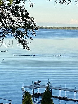
 Castle Rock Lake from the shoreline | |
| Location | Adams and Juneau County, Wisconsin, U.S. |
| Group | Petenwell and Castle Rock Stewards |
| Coordinates | 43°55′33″N 89°58′05″W / 43.9258°N 89.9680°W |
| Type | Drainage Basin |
| Primary inflows | Yellow River, Little Yellow River, Pentwell Lake, Big Roche a Cri, and Klein Creek. |
| Primary outflows | Wisconsin River |
| Basin countries | United States |
| Built | 1951 |
| Max. length | 11 mi (18 km) |
| Max. width | 4.3 mi (6.9 km) |
| Surface area | 16,640 acres (6,730 ha) |
| Average depth | 13.4 ft (4.1 m) |
| Max. depth | 35 ft (11 m) |
| Water volume | 172,000 acre⋅ft (212,000,000 m3) |
| Shore length1 | 72.9 miles (117.3 km) |
| Surface elevation | 885 ft (270 m) |
| Max. temperature | 82.8 °F (28.2 °C) |
| Min. temperature | 35.4 °F (1.9 °C) |
| Settlements | Germantown, Quincy, and Dellwood |
| 1 Shore length is not a well-defined measure. | |
Castle Rock Lake is an artificial lake on the Wisconsin River. It is located in central Wisconsin in Adams County and Juneau County. The lake has an inflow from Petenwell Lake, Yellow River, Big Roche a Cri., and Klien Creek.[1] It has a surface area of 16,640 acres (67.3 km2) and its depth varies from 8–20 ft (2.4–6.1 m) in most places, with area in the old river beds reaching as deep as 35 ft (11 m).[2]
Castle Rock Lake is the fourth largest lake in Wisconsin, it covers sixteen thousand acres, and has approximately seventy miles of shoreline.[3] Castle Rock Lake is home to a large variety of fish, birds, and many other organisms. The large body of water attracts many people to the area as well, it provides a great space for recreational hobbies such as: bird watching, boating, fishing, and recreational water sports.
- ^ "Water Detail - Castle Rock Lake, Little Roche A Cri Creek, Lower Yellow (Juneau Co.) River, Big Roche A Cri Creek Watershed (CW01, CW02, CW06)". dnr.wi.gov. Retrieved 6 October 2020.
- ^ Cite error: The named reference
DNRCRLwas invoked but never defined (see the help page). - ^ Cite error: The named reference
WRPCwas invoked but never defined (see the help page).

