Castlecliff | |
|---|---|
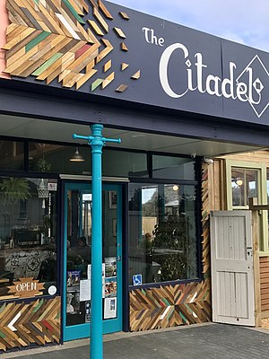
 A café in Castlecliff | |
 | |
| Coordinates: 39°56′35″S 174°59′37″E / 39.943031°S 174.993740°E | |
| Country | New Zealand |
| City | Whanganui |
| Local authority | Whanganui District Council |
| Area | |
| • Land | 865 ha (2,137 acres) |
| Population (June 2024)[2] | |
| • Total | 4,150 |
| Kai Iwi | Westmere | Tawhero |
|
|
Gonville | |
| (South Taranaki Bight) | (Whanganui River mouth) |
Castlecliff is a suburb of Whanganui, in the Whanganui District and Manawatū-Whanganui region of New Zealand's North Island. The name was given by the Harbour Board, on the suggestion of the future Prime Minister, John Ballance,[3] when it established the township on what were described as "barren sandhills" in 1882. Many of the streets were named after Harbour Board members.[4] The northern harbour breakwater extended 900 ft (270 m) by 1885.[5] The freezing works was built in 1891.[6]
- ^ Cite error: The named reference
Areawas invoked but never defined (see the help page). - ^ "Aotearoa Data Explorer". Statistics New Zealand. Retrieved 26 October 2024.
- ^ "HARBOUR BOARD Wanganui Herald". paperspast.natlib.govt.nz. 8 November 1882. Retrieved 30 June 2023.
- ^ "LOCAL AND GENERAL. Wanganui Chronicle". paperspast.natlib.govt.nz. 8 November 1882. Retrieved 30 June 2023.
- ^ "A TRIP TO THE HEADS BY RAIL. Wanganui Herald". paperspast.natlib.govt.nz. 27 April 1885. Retrieved 30 June 2023.
- ^ "THE WANGANUI FREEZING WORKS Wanganui Chronicle". paperspast.natlib.govt.nz. 10 June 1891. Retrieved 30 June 2023.