Castro Verde | |
|---|---|
 | |
 | |
| Coordinates: 37°42′15″N 8°1′23″W / 37.70417°N 8.02306°W | |
| Country | |
| Region | Alentejo |
| Intermunic. comm. | Baixo Alentejo |
| District | Beja |
| Parishes | 4 |
| Government | |
| • President | Francisco José Caldeira Duarte (CDU) |
| Area | |
| • Total | 569.44 km2 (219.86 sq mi) |
| Elevation | 234 m (768 ft) |
| Population (2011) | |
| • Total | 7,276 |
| • Density | 13/km2 (33/sq mi) |
| Time zone | UTC±00:00 (WET) |
| • Summer (DST) | UTC+01:00 (WEST) |
| Postal code | 7780 |
| Area code | 286 |
| Patron | São Pedro |
| Website | www |
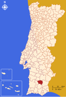
Castro Verde (European Portuguese pronunciation: [ˈkaʃtɾu ˈveɾðɨ] ) is a town and a municipality of the Alentejo region of Portugal (in the historic district of Beja). The population in 2011 was 7,276,[1] in an area of 569.44 km2.[2] Castro Verde is situated in the Baixo Alentejo subregion, within a territory known locally as the Campo Branco (English: White Plains). The municipality can be recognized by the local municipal markers along its borders, that appear within its borders to denote its reference as A Window on the Plains; municipal markers appear as stylized house profiles, with an exaggerated window that allows the visitor to see through into the panorama.
- ^ Instituto Nacional de Estatística
- ^ "Áreas das freguesias, concelhos, distritos e país". Archived from the original on 2018-11-05. Retrieved 2018-11-05.

