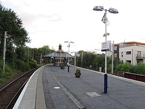
 | |||||
| General information | |||||
| Location | Cathcart, Glasgow Scotland | ||||
| Coordinates | 55°49′04″N 4°15′38″W / 55.81764°N 4.26056°W | ||||
| Grid reference | NS584605 | ||||
| Managed by | ScotRail | ||||
| Transit authority | Strathclyde Partnership for Transport | ||||
| Platforms | 2 | ||||
| Other information | |||||
| Station code | CCT | ||||
| History | |||||
| Original company | Cathcart District Railway | ||||
| Pre-grouping | Caledonian Railway | ||||
| Post-grouping | LMS | ||||
| Key dates | |||||
| 25 May 1886 | Original terminus station opened to the north of the White Cart River[1][2] | ||||
| 18 March 1894 | Original terminus closed[1][2] | ||||
| 19 March 1894 | New through station opened to the south of the White Cart River[1][2] | ||||
| Passengers | |||||
| 2018/19 | |||||
| Interchange | | ||||
| 2019/20 | |||||
| Interchange | | ||||
| 2020/21 | |||||
| Interchange | | ||||
| 2021/22 | |||||
| Interchange | | ||||
| 2022/23 | |||||
| Interchange | | ||||
| |||||
Cathcart railway station is a railway station serving the Cathcart area of Glasgow, Scotland. It is located on the Cathcart Circle Line, 3.7 miles (6 km) south of Glasgow Central (via Queens Park). Services are provided by ScotRail on behalf of Strathclyde Partnership for Transport.