You can help expand this article with text translated from the corresponding article in Portuguese. (July 2020) Click [show] for important translation instructions.
|
Caxias do Sul | |
|---|---|
| Municipality of Caxias do Sul | |
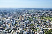
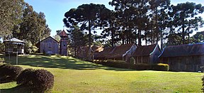
From the top, clockwise: Caxias do Sul Cathedral; Aerial view of the city; Dante Alighieri Square; landscapes around Caxias do Sul in the winter; Exhibition Park of Grapes Festival; View of Caxias do Sul and La Cave castle. | |
| Nickname: Pearl of the Colonies | |
 Location of Caxias do Sul | |
| Coordinates: 29°10′00″S 51°11′00″W / 29.16667°S 51.18333°W | |
| Country | |
| Region | South |
| State | |
| Founded | June 20, 1890 |
| Government | |
| • Mayor | Adiló Didomênico (PSDB) |
| Area | |
| 1,643.913 km2 (634.718 sq mi) | |
| • Urban | 65.5 km2 (25.3 sq mi) |
| Elevation | 817 m (2,680 ft) |
| Population (2022)[1] | |
| 463,501 | |
| • Density | 280/km2 (730/sq mi) |
| • Metro | 735,276 |
| Time zone | UTC-3 (UTC-3) |
| • Summer (DST) | Does not observe DST |
| Postal Code | 95000-000 |
| Area code | +55 54 |
| HDI (2010) | 0.782 – high[2] |
| Website | caxias |
Preview warning: Page using Template:Infobox settlement with unknown parameter "pushpin_map_size"
Caxias do Sul (Portuguese pronunciation: [kaˈʃi.ɐz du ˈsuw]) is a city in Rio Grande do Sul, Southern Brazil, situated in the state's mountainous Serra Gaúcha region. It was established by Italian immigrants on June 20, 1890. Today it is the second largest city in the state of Rio Grande do Sul. In 2020, the population of Caxias do Sul was estimated at 517,451 people, many of whom are of Italian and German descent. The demonym of the citizens of Caxias do Sul is Caxiense.[3]
- ^ IBGE 2022
- ^ "Archived copy" (PDF). United Nations Development Programme (UNDP). Archived from the original (PDF) on July 8, 2014. Retrieved August 1, 2013.
{{cite web}}: CS1 maint: archived copy as title (link) - ^ "Caxias do Sul" (in Portuguese). Brasília, Brazil: Instituto Brasileiro de Geografia e Estatística. 2017. Retrieved December 20, 2017.


