 | |
| Geography | |
|---|---|
| Location | Humacao, Puerto Rico |
| Coordinates | 18°9′23″N 65°44′3″W / 18.15639°N 65.73417°W |
| Area | 0.139179 km2 (0.053737 sq mi) |
| Length | 0.6 km (0.37 mi) |
| Width | 0.4 km (0.25 mi) |
| Highest elevation | 34.9 m (114.5 ft) |
| Highest point | El Morrillo or "Big Cay hill top" |
| Administration | |
| Commonwealth | Puerto Rico |
| Municipality | Humacao |
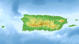
Cayo Santiago, also known as Santiago Island, Isla de los monos (or Island of the monkeys), is located at 18°09′23″N 65°44′03″W / 18.15639°N 65.73417°W, 0.59 mi (0.95 km) 0.6 mi (1.0 km) to the east of Punta Santiago, Humacao, Puerto Rico.[1][2]
- ^ Kessler, Matthew J.; Rawlins, Richard G. (2016). "A 75‐year pictorial history of the Cayo Santiago rhesus monkey colony". American Journal of Primatology. 78 (1): 6–43. doi:10.1002/ajp.22381. ISSN 1098-2345. PMC 4567979. PMID 25764995.
- ^ Congress, The Library of. "LC Linked Data Service: Authorities and Vocabularies (Library of Congress)". id.loc.gov. Retrieved 2021-03-26.


