| Cedar Mountain Formation | |
|---|---|
| Stratigraphic range: Late Berriasian-Cenomanian ~ | |
 Type section of the Cedar Mountain Formation | |
| Type | Geological formation |
| Sub-units | See text |
| Underlies | Naturita Formation |
| Overlies | Morrison Formation |
| Thickness | Varies, some sections over 1000 metres |
| Lithology | |
| Primary | Conglomerate, sandstone, mudstone |
| Location | |
| Coordinates | 39°15′00″N 110°49′26″W / 39.250°N 110.824°W |
| Approximate paleocoordinates | 40°12′N 69°00′W / 40.2°N 69.0°W |
| Region | |
| Country | |
| Type section | |
| Named for | Cedar Mountain |
| Named by | William Stokes |
| Year defined | 1944 |
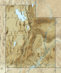
The Cedar Mountain Formation is the name given to a distinctive sedimentary geologic formation in eastern Utah, spanning most of the early and mid-Cretaceous. The formation was named for Cedar Mountain in northern Emery County, Utah, where William Lee Stokes first studied the exposures in 1944.[1]

