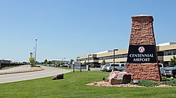
Centennial Airport | |||||||||||||||||||
|---|---|---|---|---|---|---|---|---|---|---|---|---|---|---|---|---|---|---|---|
 | |||||||||||||||||||
 | |||||||||||||||||||
| Summary | |||||||||||||||||||
| Airport type | Public | ||||||||||||||||||
| Owner | Arapahoe County Public Airport Authority | ||||||||||||||||||
| Serves | Denver–Aurora Metropolitan Area, Colorado | ||||||||||||||||||
| Location | Dove Valley CDP, Colorado | ||||||||||||||||||
| Elevation AMSL | 5,885 ft / 1,794 m | ||||||||||||||||||
| Coordinates | 39°34′12″N 104°50′58″W / 39.57000°N 104.84944°W | ||||||||||||||||||
| Website | http://www.centennialairport.com/ | ||||||||||||||||||
| Maps | |||||||||||||||||||
 FAA airport diagram | |||||||||||||||||||
 | |||||||||||||||||||
| Runways | |||||||||||||||||||
| |||||||||||||||||||
| Statistics (2018) | |||||||||||||||||||
| |||||||||||||||||||
Centennial Airport (IATA: APA, ICAO: KAPA, FAA LID: APA) is a public use airport owned by the Arapahoe County Public Airport Authority in the Denver-Aurora metropolitan area, 15 nautical miles (17 mi, 28 km) southeast of downtown Denver, Colorado, United States.[1] Located in Dove Valley,[2] a census designated place in Arapahoe County, the airport's runways extend into Douglas County.[3][4]
- ^ a b FAA Airport Form 5010 for APA PDF. Federal Aviation Administration. Effective May 31, 2012.
- ^ "Dove Valley Business Park". Dove Valley Metropolitan District. Archived from the original on 2015-04-02. Retrieved 2015-03-11. The postal designation of Englewood, a city located some 7 miles (11 km) west of Dove Valley CDP, is used in the airport's mailing address. Centennial Airport: Contact Details Archived April 2, 2015, at the Wayback Machine. Retrieved 2015-03-11.
- ^ "2020 CENSUS - CENSUS BLOCK MAP: Dove Valley CDP, CO" (PDF). U.S. Census Bureau. Retrieved 2022-08-03.
Centennial Arprt
- 2010 map (Archive) - ^ "Directions" (). Centennial Airport. Retrieved on April 1, 2015.

