| Cerro Ascotan | |
|---|---|
| del Jardin | |
 Cerro Ascotan seen from Salar de Ascotán | |
| Highest point | |
| Elevation | 5,473 m (17,956 ft)[1] |
| Coordinates | 21°41′S 68°07′W / 21.683°S 68.117°W[2] |
| Geography | |
| Location | Chile / Bolivia |
| Geology | |
| Mountain type | Stratovolcano[1] |
| Last eruption | Pleistocene [1] |
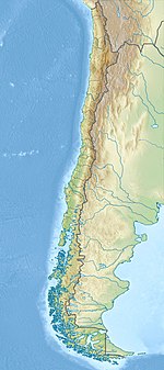
Cerro Ascotan (also known as del Jardin[3]) is a volcano on the border between Chile and Bolivia. It is 5,473 metres (17,956 ft) high,[1] 1,770 metres (5,810 ft) above the terrain and a maximum slope in the summit area of 26°. A breach in the edifice is 1.9 kilometres (1.2 mi) wide and 3.4 kilometres (2.1 mi) long, with an azimuth of 252°.[2] The current snowline lies between 5,700–5,900 metres (18,700–19,400 ft); during the Pleistocene it was lower at 4,900–5,000 metres (16,100–16,400 ft).[4] The volcano's summit, about one third thereof, was removed by a large explosion,[3] with debris thrown at large distances.[5] Volcanic activity probably occurred during the Pleistocene.[1] The volcano is neighbor to Cerro Araral.
- ^ a b c d e Cite error: The named reference
GVPwas invoked but never defined (see the help page). - ^ a b Cite error: The named reference
FrancisWells1988was invoked but never defined (see the help page). - ^ a b Cite error: The named reference
Zeil1964was invoked but never defined (see the help page). - ^ Cite error: The named reference
Singh1992was invoked but never defined (see the help page). - ^ Cite error: The named reference
Grove1893was invoked but never defined (see the help page).

