Chagrin Falls Township | |
|---|---|
 Scene on Falls River Road northeast of Chagrin Falls village limits | |
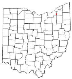
 Location of Chagrin Falls Township in Ohio | |
 Location of Chagrin Falls Township in Cuyahoga County | |
| Coordinates: 41°25′52″N 81°23′27″W / 41.43111°N 81.39083°W | |
| Country | United States |
| State | Ohio |
| County | Cuyahoga |
| Area | |
• Total | 2.6 sq mi (6.8 km2) |
| • Land | 2.6 sq mi (6.7 km2) |
| • Water | 0.0 sq mi (0.1 km2) |
| Elevation | 919 ft (280 m) |
| Population (2010) | |
• Total | 4,317 |
| • Density | 1,700/sq mi (630/km2) |
| Time zone | UTC-5 (Eastern (EST)) |
| • Summer (DST) | UTC-4 (EDT) |
| ZIP code | 44022 |
| Area code | 440 |
| FIPS code | 39-13372[2] |
| GNIS feature ID | 1085961[1] |
Chagrin Falls Township is a township located in Cuyahoga County, Ohio, United States. As of the 2020 census, the township had a total population of 4,317, which includes the village of Chagrin Falls.[3] The portion of the township outside the village limits had a population of 129 at the 2020 census.[4] The unincorporated township consists of about 44 households[5] on an area of 0.52 square miles (1.3 km2), resulting in a population density of 261.7 persons/mile² (101.0 persons/km2).[6] It is one of only two civil townships remaining in Cuyahoga County (the other being Olmsted Township) and the only Chagrin Falls Township statewide.[7]
- ^ a b "US Board on Geographic Names". United States Geological Survey. October 25, 2007. Retrieved January 31, 2008.
- ^ "U.S. Census website". United States Census Bureau. Retrieved January 31, 2008.
- ^ "Profile of General Population and Housing Characteristics: 2020 Demographic Profile Data (DP-1): Chagrin Falls township, Cuyahoga County, Ohio". United States Census Bureau. Retrieved November 23, 2021.
- ^ Subtracting 2020 census population of village from population of township.
- ^ Cuyahoga County Households and Household Size Archived 2006-09-23 at the Wayback Machine, Cuyahoga County Planning Commission. Accessed 2006-12-28
- ^ Cuyahoga County Land Area and Population Density Archived 2006-09-23 at the Wayback Machine, Cuyahoga County Planning Commission. Accessed 2006-12-28
- ^ "Geographic Areas Reference Map Series - Ohio" (PDF). United States Census Bureau. 2023. Retrieved June 17, 2024.