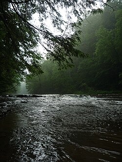
| Chagrin River | |
|---|---|
 Chagrin River from South Chagrin Reservation | |
 | |
| Location | |
| Country | United States |
| State | Ohio |
| Physical characteristics | |
| Source | Bass Lake, Ohio |
| • location | Munson Township, Northeast Ohio |
| Mouth | Chagrin Harbor |
• location | Eastlake, Lake County, OH |
• coordinates | 41°40′36″N 81°26′13″W / 41.67667°N 81.43694°W |
| Discharge | |
| • location | Eastlake, OH |
The Chagrin River is located in Northeast Ohio.[1] The river has two branches, the Aurora Branch and East Branch. Of three hypotheses as to the origin of the name, the most probable is that it is a corruption of the name of a Frenchman, Sieur de Seguin, who established a trading post on the river ca. 1742.[2][3][4] The Chagrin River runs through suburban areas of Greater Cleveland in Cuyahoga, Geauga, and Portage counties, transects two Cleveland Metroparks reservations, and then meanders into nearby Lake County before emptying into Lake Erie.
The East Branch begins in Geauga County, flows north then west through Lake County, largely in Kirtland, and Kirtland Hills. In these communities the East Branch transects the Holden Arboretum, before intersecting the main in Willoughby.[5]
The Aurora Branch begins in northwest Portage County, flowing northwest through Aurora and portions of Geauga and Cuyahoga Counties, intersecting the main branch west of Chagrin Falls.[6]
The Chagrin River was designated as a state scenic river in 1979.
- ^ U.S. Geological Survey Geographic Names Information System: Chagrin River
- ^ Chagrin State Scenic River, Ohio Department of Natural Resources. Accessed 2007-09-08.
- ^ "Chagrin River." The Encyclopedia of Cleveland History. July 10, 1997. Accessed February 9, 2007.
- ^ "Chagrin Falls, an Ohio Village History", ISBN 0-9753051-0-7, pub. 2005 by The Chagrin Falls Historical Society
- ^ U.S. Geological Survey Geographic Names Information System: East Branch Chagrin River
- ^ U.S. Geological Survey Geographic Names Information System: Aurora Branch