Chamberlain
Makȟáthipi (Lakota) | |
|---|---|
 Akta Lakota Museum, 2003 | |
| Motto: "One day just isn't enough..." | |
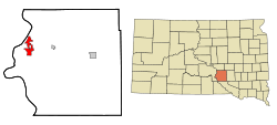
 Location in Brule County and the state of South Dakota | |
| Coordinates: 43°48′20″N 99°19′42″W / 43.80556°N 99.32833°W | |
| Country | United States |
| State | South Dakota |
| County | Brule |
| Founded | 1881[1] |
| Area | |
• Total | 5.67 sq mi (14.70 km2) |
| • Land | 4.48 sq mi (11.60 km2) |
| • Water | 1.20 sq mi (3.10 km2) |
| Elevation | 1,404 ft (428 m) |
| Population | |
• Total | 2,473 |
| • Density | 552.13/sq mi (213.16/km2) |
| Time zone | UTC−6 (Central (CST)) |
| • Summer (DST) | UTC−5 (CDT) |
| ZIP codes | 57325-57326 |
| Area code | 605 |
| FIPS code | 46-11220[4] |
| GNIS feature ID | 1265153[5] |
| Website | {{}} |
Chamberlain is a city in Brule County, South Dakota, United States. It is located on the east bank of the Missouri River, at the dammed section of the Lake Francis Case, close to where it is crossed by Interstate 90.
The population of Chamberlain was 2,473 at the 2020 census.[6] It is the county seat of Brule County.[7]
Chamberlain is home to the South Dakota Hall of Fame, and the 50-foot tall Dignity statue is nearby.
- ^ "SD Towns" (PDF). South Dakota State Historical Society. Archived from the original (PDF) on February 10, 2010. Retrieved February 11, 2010.
- ^ "ArcGIS REST Services Directory". United States Census Bureau. Retrieved October 15, 2022.
- ^ Cite error: The named reference
USCensusDecennial2020CenPopScriptOnlywas invoked but never defined (see the help page). - ^ "U.S. Census website". United States Census Bureau. Retrieved January 31, 2008.
- ^ "US Board on Geographic Names". United States Geological Survey. October 25, 2007. Retrieved January 31, 2008.
- ^ "U.S. Census Bureau: Chamberlain city, South Dakota". www.census.gov. United States Census Bureau. Retrieved June 27, 2022.
- ^ "Find a County". National Association of Counties. Retrieved June 7, 2011.