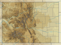
| Chambers Lake | |
|---|---|
 The lake in summer | |
| Location | Larimer County, Colorado |
| Coordinates | 40°36′16″N 105°51′12″W / 40.6045224°N 105.8533750°W[1] |
| Type | Reservoir |
| Etymology | Named for Robert Chambers, a trapper who camped at the site in 1858[2] |
| Primary inflows | Fall Creek, Skyline Ditch, Joe Wright Creek |
| Primary outflows | Joe Wright Creek |
| Managing agency | The Water Supply and Storage Company |
| Surface area | 255 acres (103 ha)[3] |
| Water volume | 11,350 acre⋅ft (14,000,000 m3)[4] |
| Surface elevation | 2,791 m (9,157 ft) [1] |
Chambers Lake is a reservoir in Larimer County, Colorado. Located within the Roosevelt National Forest, the reservoir supplies water for irrigation and municipal water supply.
The reservoir is owned by the Water Supply and Storage Company, based in Fort Collins. The city of Thornton owns a large proportion of the company's stock.[5] Water from the reservoir makes its way to the Cache la Poudre River. It then flows down through Poudre Canyon to Colorado's Eastern Plains, where it is distributed.
- ^ a b "Chambers Lake". Geographic Names Information System. United States Geological Survey, United States Department of the Interior. Retrieved Jan 15, 2021.
- ^ "Chambrers Lake". Colorado State University. Public Lands History Center. Colorado State University. Retrieved 2017-08-31.
Chambers Lake, at 9,300 feet above sea level in the Medicine Bow Range, is named for trapper Robert Chambers, who camped there with his son in 1858.
- ^ Davies, Kurt (2013). "Chambers Lake Fish Survey and Management Data" (PDF). Colorado Parks and Wildlife. Retrieved 2017-08-31.
- ^ Lakepedia. Chambers Lake, Colorado. Viewed: 2017-08-31
- ^ "Guide to the Water Supply and Storage Company Collection". Colorado State University Libraries. Retrieved 2017-08-31.
In 1986, the city of Thornton purchased substantial stock in the company, which has subsequently provided water for both municipal and agricultural purpose
