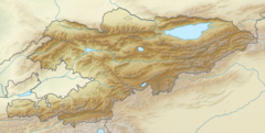
| Chandalash Sandalash | |
|---|---|
| Native name | Чандалаш (Kyrgyz) |
| Location | |
| Country | Kyrgyzstan |
| Region | Jalal-Abad Region |
| District | Chatkal District |
| Physical characteristics | |
| Source | Talas Alatau |
| Mouth | Chatkal |
• coordinates | 41°40′55″N 70°52′38″E / 41.6820°N 70.8771°E |
| Length | 94 km (58 mi) |
| Basin size | 1,157 km2 (447 sq mi) |
| Discharge | |
| • average | 11.7 m3/s (410 cu ft/s) |
| • minimum | 2.8 m3/s (99 cu ft/s) |
| • maximum | 30.1 m3/s (1,060 cu ft/s) |
| Basin features | |
| Progression | Chatkal→ Chirchiq→ Syr Darya→ North Aral Sea |
| Tributaries | |
| • right | Kaiyng-Suu, |
The Chandalash (Kyrgyz: Чандалаш) is a river in the Pskem Mountains of Chatkal District in Jalal-Abad Region in western Kyrgyzstan. The river is formed at the south west slope of Talas Alatau and flows into the Chatkal. It is 94 kilometres (58 mi) long, and has a drainage basin of 1,157 square kilometres (447 sq mi). The average annual discharge is 11.7 m3/s (410 cu ft/s). The maximum flow is 30.1 m3/s (1,060 cu ft/s) in June, and the minimum - 2.7 m3/s (95 cu ft/s) - 2.8 m3/s (99 cu ft/s) in March. [1][2]
- ^ "Чандалаш" [Chandalash] (PDF). Кыргызстандын Географиясы [Geography of Kyrgyzstan] (in Kyrgyz). Bishkek. 2004. p. 210.
{{cite encyclopedia}}: CS1 maint: location missing publisher (link) - ^ Ошская область:Энциклопедия [Encyclopedia of Osh Oblast] (in Russian). Bishkek: Chief Editorial Board of Kyrgyz Soviet Encyclopedia. 1987. p. 445.
