Chandrapur
Chanda | |
|---|---|
City | |
 | |
| Nickname: Black Gold City | |
 Chandrapur in Maharashtra | |
| Coordinates: 19°57′00″N 79°17′49″E / 19.950°N 79.297°E | |
| Country | |
| State | Maharashtra |
| District | Chandrapur |
| Founded by | Khandkya Ballal Shah |
| Named for | Mahakali Temple |
| Government | |
| • Type | Mahanagar Palika |
| • Body | Chandrapur Municipal Corporation |
| • Mayor | Rakhi Kacharlawar |
| • Municipal Commissioner | Vipin Paliwal, IAS |
| • Chairman, Standing Committee | Ramu Tiwary |
| Area | |
• Total | 76 km2 (29 sq mi) |
| Elevation | 188 m (617 ft) |
| Population (2024) | |
• Total | 518,000 Chandrapur Urban Area |
| • Rank | Vidarbha: 4th |
| • Density | 4,200/km2 (11,000/sq mi) |
| Demonym | Chandrapurkar |
| Language | |
| • Official | Marathi |
| Time zone | UTC+5:30 (IST) |
| PIN | 442401,442402,442403,442404 |
| Telephone code | (+91), 7172 |
| Vehicle registration | MH-34 |
| Website | Official website |
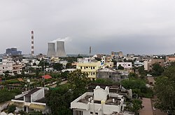
Chandrapur (earlier known as Chanda, the official name until 1964) is a city and a municipal corporation in Chandrapur district, Maharashtra state, India. It is the district headquarters of Chandrapur district. Chandrapur is a fort city founded by Khandkya Ballal Shah, a Gond king of the 13th century.[1] The city sits at the confluence of the Erai river and Zarpat river. The area around the city is rich in coal seams.[citation needed]. Hence, Chandrapur is also known as the "Black Gold City".[2]
- ^ Deogaonkar, Shashishekhar (2007). The Gonds of Vidarbha. Concept Publishing Company, 2007. p. 37. ISBN 978-8180694745.
- ^ EARTHCARE LABS PVT. LTD (March 2017). PRE FEASIBILITY REPORT of Stone Quarry (PDF). Nagpur: EARTHCARE LABS PVT. LTD. p. 2(iv). Retrieved 12 December 2019.