Changnyeong-eup
창녕읍 | |
|---|---|
| Korean transcription(s) | |
| • Hangul | 창녕읍 |
| • Hanja | 昌寧邑 |
| • Revised Romanization | Changnyeong-eub |
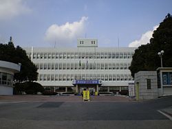
 County Hall | |
 Location in South Korea | |
| Country | |
| Region | Gyeongnam |
| Established | 555 |
| Administrative divisions | 17 Legal village 법정리, 31 administrative villages 행정리, 161 neighborhoods 반 |
| Government | |
| • Mayor | Chung Shik Kim 김충식 |
| Area | |
| • Total | 61.42 km2 (23.71 sq mi) |
| Elevation | 2 m (7 ft) |
| Population (April 2013) | |
| • Total | 16,723 |
| • Dialect | Gyeongsang |
| Time zone | UTC+09:00 |
| Website | Changnyeong City Office |
Changnyeong-eup (창녕읍, 昌寧邑) is a town (eup) in the administrative county of Changnyeong, South Gyeongsang Province, in South Korea.[1]
The town is Changnyeong county's administrative, business, and traffic center where most of the farm produce is bought and sold. It is nearly in the center of the county and is accessible via the Seoul-Busan expressway and national roads 5 and 24.
Changnyeong Town contains many national treasures and is situated in the middle of Changnyeong county's three major tourist attractions, Upo wetland, Bugok natural hotsprings, and Hwawang mountain.[1]
- ^ a b English. "Changyeong-Gun". eng.cng.go.kr.