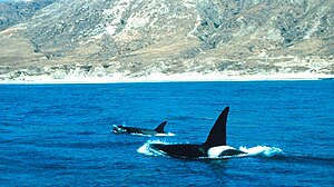
| Channel Islands National Marine Sanctuary | |
|---|---|
IUCN category V (protected landscape/seascape) | |
 | |
| Coordinates | 34°N 120°W / 34°N 120°W |
| Area | 1,470 sq mi (3,800 km2) |
| Established |
|
| Governing body | National Oceanic and Atmospheric Administration |
| www | |


The Channel Islands National Marine Sanctuary[1] is a sanctuary off the coast of Santa Barbara and Ventura counties in Southern California 350 miles (563 km) south of San Francisco and 95 miles (153 km) north of Los Angeles. It was designated on October 2, 1980, by the National Oceanic and Atmospheric Administration and was expanded in 2007.[2]
- ^ "Channel Islands National Marine Sanctuary". channelislands.noaa.gov. Retrieved November 6, 2023.
- ^ "Sanctuary Designations & Expansions". NOAA. Retrieved October 17, 2024.

