| Chara Yakut: Чаара | |
|---|---|
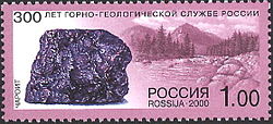
 View of the river and piece of charoite | |
Location in the Sakha Republic, Russia | |
| Location | |
| Country | Yakutia, Russia |
| Physical characteristics | |
| Source | |
| • location | Bolshoye Leprindo Lake |
| • coordinates | 56°38′40″N 117°35′4″E / 56.64444°N 117.58444°E |
| • elevation | 975 m (3,199 ft) |
| Mouth | Olyokma |
• coordinates | 60°19′10″N 120°52′28″E / 60.31944°N 120.87444°E |
• elevation | 126 m (413 ft) |
| Length | 851 km (529 mi) |
| Basin size | 87,600 km2 (33,800 sq mi) |
| Discharge | |
| • average | 638.83 m3/s (22,560 cu ft/s) |
| Basin features | |
| Progression | Olyokma→ Lena→ Laptev Sea |

The Chara (Russian: Ча́ра; Yakut: Чаара, Çaara) is a left tributary of the Olyokma in Eastern Siberia, Russia. It is 851 kilometres (529 mi) long, and has a drainage basin of 87,600 square kilometres (33,800 sq mi).[1]
Together with the Olyokma, river Chara gives its name to the Olyokma-Chara Plateau (Олёкмо-Чарское плоскогорье), located to the east of its eastern bank.[2]
