Charette | |
|---|---|
 Church Notre-Dame-des-Neiges | |
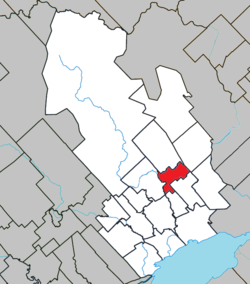
 Location within Maskinongé RCM. | |
| Coordinates: 46°27′N 72°56′W / 46.450°N 72.933°W[1] | |
| Country | |
| Province | |
| Region | Mauricie |
| RCM | Maskinongé |
| Settled | c. 1875 |
| Constituted | February 9, 1918 |
| Government | |
| • Mayor | Claude Boulanger |
| • Federal riding | Berthier—Maskinongé |
| • Prov. riding | Maskinongé |
| Area | |
| • Total | 42.20 km2 (16.29 sq mi) |
| • Land | 41.90 km2 (16.18 sq mi) |
| Population (2021)[3] | |
| • Total | 1,034 |
| • Density | 24.7/km2 (64/sq mi) |
| • Pop 2016-2021 | |
| • Dwellings | 519 |
| Time zone | UTC−5 (EST) |
| • Summer (DST) | UTC−4 (EDT) |
| Postal code(s) | |
| Area code | 819 |
| Highways | |
| Website | www.municipalite -charette.ca |
Charette (French pronunciation: [ʃaʁɛt] ) is a municipality of about 1000 people located in Maskinongé Regional County Municipality, in Quebec, Canada.
- ^ Cite error: The named reference
toponymiewas invoked but never defined (see the help page). - ^ a b Ministère des Affaires municipales, des Régions et de l'Occupation du territoire - Répertoire des municipalités: Charette Archived 2014-07-16 at the Wayback Machine
- ^ a b Cite error: The named reference
cp2021was invoked but never defined (see the help page).
