| Charlies Bunion | |
|---|---|
 The characteristic boulder-like protrusion on northern face of Charlies Bunion, with the summit rising on the right | |
| Highest point | |
| Elevation | 5,528 ft (1,685 m)[1] |
| Prominence | 140 feet (43 m)[2] |
| Coordinates | 35°38′21.26″N 83°22′18.43″W / 35.6392389°N 83.3717861°W[1] |
| Geography | |
| Location | |
| Parent range | Great Smoky Mountains |
| Topo map | USGS Mount Guyot |
| Climbing | |
| Easiest route | Appalachian Trail from Newfound Gap |
Charlies Bunion is a mountain in the Great Smoky Mountains of the Southeastern United States, characterized by a large boulder-like protrusion just below the summit on its otherwise-sheer northern face. The mountain is a rare instance of a bare-rock summit in the Smokies.
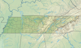
Charlies Bunion rises to an elevation of 5,528 feet (1,685 m) above sea level, and is situated along the state line between Sevier County, Tennessee and Swain County, North Carolina. The Appalachian Trail crosses the mountain's northern slope some four miles (6 km) east of Newfound Gap, allowing day-hikers and rock climbers easy access.
- ^ a b "Charlies Bunion". Geographic Names Information System. United States Geological Survey, United States Department of the Interior. Retrieved 2008-12-28.
- ^ "Charlies Bunion". Peakbagger.com. Retrieved 2024-05-24.

