Chatsworth | |
|---|---|
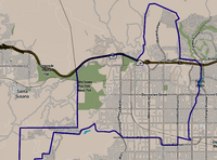
 Chatsworth neighborhood as mapped by the Los Angeles Times | |
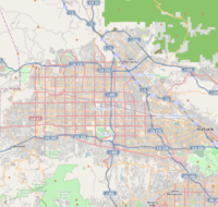
| Coordinates: 34°15′26″N 118°36′04″W / 34.25722°N 118.60111°W | |
| Country | United States |
| State | California |
| County | Los Angeles |
| City | Los Angeles |
| Named for | Chatsworth House |
| Elevation | 978 ft (298 m) |
| Population (2000)[1] | |
• Total | 41,255 |
| Time zone | UTC-8 (PST) |
| • Summer (DST) | UTC-7 (PDT) |
| ZIP code | 91311 |
| Area code(s) | 747 and 818 |
Chatsworth is a suburban neighborhood in Los Angeles, California, in the San Fernando Valley.
The area was home to Native Americans, who left caves containing rock art. Chatsworth was explored and colonized by the Spanish beginning in the 18th century. The land was part of a Spanish land grant, Rancho Ex-Mission San Fernando, in the 19th century, and after the United States took over the land following the Mexican–American War, it was the largest such grant in California.
Chatsworth has seven public and eight private schools. There are large open-space and smaller recreational parks as well as a public library and a transportation center. Distinctive features are the former Chatsworth Reservoir and the Santa Susana Field Laboratory.
The neighborhood has one of the lowest population densities in Los Angeles and a relatively high income level.
Chatsworth is the home of the Iverson Movie Ranch, a 500-acre area which was the most filmed movie ranch in history, as more than 2,000 productions used it as a filming location.
- ^ "Los Angeles Almanac: City of Los Angeles Population by Community & Race 2000 Census". Archived from the original on January 11, 2010. Retrieved April 5, 2010.
