| Chautauqua Lake | |
|---|---|
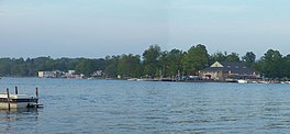
 View from Stow, New York, towards Bemus Point | |
| Location | Chautauqua County, New York, United States |
| Coordinates | 42°09′22″N 79°23′44″W / 42.15611°N 79.39556°W |
| Lake type | Natural |
| Primary inflows | Big Inlet |
| Primary outflows | Chadakoin River |
| Catchment area | 180 sq mi (470 km2) |
| Basin countries | United States |
| Max. length | 17 mi (27 km) |
| Max. width | 2 mi (3.2 km) |
| Surface area | 13,000 acres (5,300 ha) |
| Max. depth | 78 ft (24 m) |
| Shore length1 | 41 mi (66 km) |
| Surface elevation | 1,308 ft (399 m) |
| Settlements | Jamestown |
| 1 Shore length is not a well-defined measure. | |
Chautauqua Lake is located entirely within Chautauqua County, New York, United States. The lake is approximately 17 miles (27 km) long and two miles (3.2 km) wide at its greatest width. The surface area is approximately 13,000 acres (53 km2). The maximum depth is about 78 feet (24 m). The shoreline is about 41.1 miles (66 km) of which all but 2.6 mi (4 km) are privately owned.
The lake's name comes from the now-extinct Erie language. Because the Erie people were defeated in the Beaver Wars before a comprehensive study of their language could be made, its meaning remains unknown and a source of speculation, with two longstanding folk translations being “bag tied in the middle” and “place where fish are taken out,”[1] the latter having some support based on similar words in other Iroquoian languages.[2] A Seneca legend, dating at least to the days of Seneca diplomat John Cornplanter Abeel, attests to the Chautauqua having a reputation as a "place of easy death."[2]
- ^ "Stories behind names of many familiar places". Olean Times Herald. February 7, 2016. Retrieved August 29, 2016.
- ^ a b John Phillips Downs; Fenwick Y Hedley (1921). History of Chautauqua County, New York, and Its People. American Historical Society. p. 11. Retrieved March 4, 2013.

