This article needs additional citations for verification. (January 2018) |
This article is written like a personal reflection, personal essay, or argumentative essay that states a Wikipedia editor's personal feelings or presents an original argument about a topic. (January 2018) |
Chenango Canal Summit Level | |
 | |
| Nearest city | Norwich |
|---|---|
| Coordinates | 42°52′19″N 75°33′33″W / 42.87194°N 75.55917°W |
| Area | 0 acres (0 ha) |
| Built | 1833 |
| MPS | Historic and Engineering Resources of the Chenango Canal MPS |
| NRHP reference No. | 05000684[1] |
| Added to NRHP | July 6, 2005 |
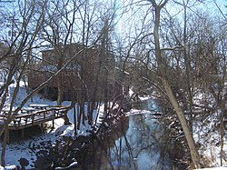
The Chenango Canal was a towpath canal in central New York in the United States which linked the Susquehanna River to the Erie Canal.[2] Built and operated in the mid-19th century, it was 97 miles long and for much of its course followed the Chenango River, along New York State Route 12 from Binghamton on the south end to Utica on the north. It operated from 1834 to 1878 and provided a significant link in the water transportation system of the northeastern U.S. until supplanted by the region's developing railroad network.
- ^ "National Register Information System". National Register of Historic Places. National Park Service. March 13, 2009.
- ^ "Chenango Country Historical Society: The Chenango Canal". Archived from the original on September 9, 2007. Retrieved September 9, 2007.

