This article needs additional citations for verification. (August 2020) |
Cheraw | |
|---|---|
 | |
| Motto: "Industry ~ Progress ~ History ~ Beauty" | |
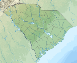
 Location of Cheraw, South Carolina | |
| Coordinates: 34°41′48″N 79°53′42″W / 34.69667°N 79.89500°W | |
| Country | United States |
| State | South Carolina |
| Counties | Chesterfield, Marlboro |
| Government | |
| • Type | Council-Manager |
| • Mayor | David Byrd |
| • Mayor Pro Tempore | Cherryl Melton |
| Area | |
| • Total | 5.99 sq mi (15.53 km2) |
| • Land | 5.95 sq mi (15.42 km2) |
| • Water | 0.04 sq mi (0.11 km2) |
| Elevation | 167 ft (51 m) |
| Population | |
| • Total | 5,040 |
| • Density | 846.63/sq mi (326.87/km2) |
| Time zone | UTC-5 (Eastern (EST)) |
| • Summer (DST) | UTC-4 (EDT) |
| ZIP code | 29520 |
| Area code(s) | 843, 854 |
| FIPS code | 45-13600[3] |
| GNIS feature ID | 1247267[4] |
| Website | www |


Cheraw (/tʃəˈrɔː/ chə-RAW, locally /ʃəˈrɔː/ shə-RAW) is a town on the Pee Dee River in Chesterfield County, South Carolina, United States. The population was 5,040 at the 2020 census.[5] The greater Cheraw area in the zip code 29520 has a population of 13,689 according to the 2019 ACS data. It has been nicknamed "The Prettiest Town in Dixie".[6] More than half the population is African American.
- ^ "ArcGIS REST Services Directory". United States Census Bureau. Retrieved October 15, 2022.
- ^ Cite error: The named reference
USCensusDecennial2020CenPopScriptOnlywas invoked but never defined (see the help page). - ^ "U.S. Census website". United States Census Bureau. Retrieved January 31, 2008.
- ^ "US Board on Geographic Names". United States Geological Survey. October 25, 2007. Retrieved January 31, 2008.
- ^ "Explore Census Data". data.census.gov. Retrieved August 10, 2022.
- ^ Staff (February 14, 2014). "Daytrips: 'The prettiest town in Dixie'". SCNow. Retrieved August 12, 2020.


