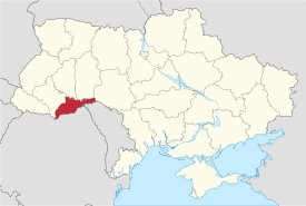
Chernivtsi Oblast
Чернівецька область | |
|---|---|
| Chernivetska oblast[1] | |
|
| |
 | |
| Coordinates: 48°17′N 26°01′E / 48.28°N 26.01°E | |
| Country | |
| Established | August 9, 1940 |
| Administrative center | Chernivtsi |
| Largest cities | Chernivtsi, Storozhynets, Novodnistrovsk |
| Government | |
| • Governor | Ruslan Zaparanyuk[2] |
| • Oblast council | 64 seats |
| • Chairperson | Oleksiy Boyko (Independent) |
| Area | |
• Total | 8,097 km2 (3,126 sq mi) |
| • Rank | Ranked 25th |
| Population (2022)[3] | |
• Total | |
| • Rank | Ranked 26th |
| • Annual growth | −0.4% |
| GDP | |
| • Total | ₴ 55 billion (€1.4 billion) |
| • Per capita | ₴ 61,088 (€1,600) |
| Time zone | UTC+2 (EET) |
| • Summer (DST) | UTC+3 (EEST) |
| Postal code | 58-60xxx |
| Area code | +380-37 |
| ISO 3166 code | UA-77 |
| Vehicle registration | СЕ |
| Raions | 11 |
| Cities (total) | 11 |
| • Regional cities | 2 |
| Urban-type settlements | 8 |
| Villages | 398 |
| HDI (2022) | 0.722[5] high |
| FIPS 10-4 | UP03 |
| Website | bukoda.gov.ua oblrada.cv.ua |
Chernivtsi Oblast (Ukrainian: Чернівецька область, romanized: Chernivetska oblast), also referred to as Chernivechchyna (Чернівеччина), is an oblast (province) in western Ukraine, consisting of the northern parts of the historical regions of Bukovina and Bessarabia. It has an international border with Romania and Moldova. The region spans 8,100 square kilometres (3,100 sq mi). The oblast is the smallest in Ukraine both by area and population. It has a population of 890,457 (2022 estimate),[3] and its administrative center is the city of Chernivtsi.
In 1408, Chernivtsi was a town in Moldavia and the chief centre of the area known as Bukovina. Chernivtsi later passed to the Turks and then in 1774 to the Habsburg monarchy. After World War I, it was ceded to Romania, and in 1940, the town was acquired by the Ukrainian SSR.
The oblast has a large variety of landforms: the Carpathian Mountains and picturesque hills at the foot of the mountains gradually change to a broad partly forested plain situated between the Dniester and Prut rivers.
- ^ Syvak, Nina; Ponomarenko, Valerii; Khodzinska, Olha; Lakeichuk, Iryna (2011). Veklych, Lesia (ed.). Toponymic Guidelines for Map and Other Editors for International Use (PDF). scientific consultant Iryna Rudenko; reviewed by Nataliia Kizilowa; translated by Olha Khodzinska. Kyiv: DerzhHeoKadastr and Kartographia. p. 20. ISBN 978-966-475-839-7. Retrieved 2020-10-06.
{{cite book}}:|website=ignored (help) - ^ "УКАЗ ПРЕЗИДЕНТА УКРАЇНИ No: 486/2022". president.gov.ua (in Ukrainian). Retrieved 5 February 2023.
- ^ a b Чисельність наявного населення України на 1 січня 2022 [Number of Present Population of Ukraine, as of January 1, 2022] (PDF) (in Ukrainian and English). Kyiv: State Statistics Service of Ukraine. Archived (PDF) from the original on 4 July 2022.
- ^ "Валовии регіональнии продукт".
- ^ "Sub-national HDI - Area Database - Global Data Lab". hdi.globaldatalab.org.

