Cherry County | |
|---|---|
 Cherry County Courthouse in Valentine | |
 Location within the U.S. state of Nebraska | |
 Nebraska's location within the U.S. | |
| Coordinates: 42°32′N 101°07′W / 42.54°N 101.12°W | |
| Country | |
| State | |
| Founded | 1883 |
| Named for | Samuel A. Cherry |
| Seat | Valentine |
| Largest city | Valentine |
| Area | |
• Total | 6,009 sq mi (15,560 km2) |
| • Land | 5,960 sq mi (15,400 km2) |
| • Water | 49 sq mi (130 km2) 0.8% |
| Population (2020) | |
• Total | 5,455 |
| • Density | 0.91/sq mi (0.35/km2) |
| Time zones | |
| Eastern part of county | UTC−6 (Central) |
| • Summer (DST) | UTC−5 (CDT) |
| Western part of county | UTC−7 (Mountain) |
| • Summer (DST) | UTC−6 (MDT) |
| Congressional district | 3rd |
| Website | www |

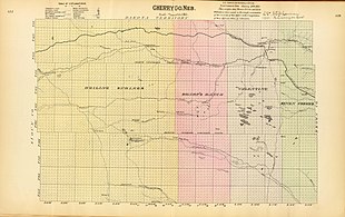
*Boiling Springs
*Sharp's Ranch
*Valentine
*Seven Creeks


Cherry County is a county in the U.S. state of Nebraska. As of the 2020 United States Census, the population was 5,455.[1] Its county seat is Valentine.[2] The county was named for Lt. Samuel A. Cherry, an Army officer who was stationed at Fort Niobrara and was killed in South Dakota in 1881.[3] Cherry County is in the Nebraska Sandhills. It is the state's largest county, at nearly 6,000 square miles (16,000 km2), larger than the state of Connecticut.
In the Nebraska license plate system, Cherry County is represented by the prefix 66 (it had the 66th-most vehicles registered in the state when the system was established in 1922).
- ^ "Cherry County, Nebraska Profile". US Census Bureau. Retrieved January 20, 2023.
- ^ "Find a County". National Association of Counties. Archived from the original on May 3, 2015. Retrieved June 7, 2011.
- ^ Cherry County Archived March 8, 2008, at the Wayback Machine, Nebraska Association of County Officials, 2004. Accessed April 30, 2008.