| Cherry River | |
|---|---|
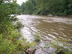
 Cherry River in Nicholas County after heavy rains | |
| Location | |
| Country | United States |
| Physical characteristics | |
| Source | |
| • location | Pocahontas County, West Virginia (North and South Forks) |
| • elevation | 2,226 ft (678 m) (at confluence of forks at Richwood)[1] |
| Mouth | |
• location | Gauley River, Nicholas County, West Virginia |

The Cherry River is a tributary of the Gauley River in southeastern West Virginia in the United States. Via the Gauley, Kanawha and Ohio rivers, it is part of the watershed of the Mississippi River. The Cherry River drains mostly rural and forested areas and flows for much of its length through the Monongahela National Forest.[2] Throughout its entire length the Cherry goes over a series of whitewater rapids in a mountainous setting.
- ^ Arnold, Amy Donaldson. 2006. "Richwood." The West Virginia Encyclopedia. Ken Sullivan, editor. Charleston, WV: West Virginia Humanities Council. ISBN 0-9778498-0-5.
- ^ DeLorme (1997). West Virginia Atlas & Gazetteer. Yarmouth, Maine: DeLorme. ISBN 0-89933-246-3.