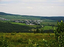
Chesterville | |
|---|---|
 | |
| Nickname: Quebec's little Switzerland | |
 Location within Arthabaska RCM. | |
| Coordinates: 45°58′N 71°49′W / 45.967°N 71.817°W[1] | |
| Country | |
| Province | |
| Region | Centre-du-Québec |
| RCM | Arthabaska |
| Settled | 1835-1849 |
| Constituted | December 18, 1982 |
| Government | |
| • Mayor | Louis Lafleur |
| • Federal riding | Richmond—Arthabaska |
| • Prov. riding | Drummond–Bois-Francs |
| Area | |
• Total | 117.00 km2 (45.17 sq mi) |
| • Land | 116.72 km2 (45.07 sq mi) |
| Population | |
• Total | 877 |
| • Density | 7.5/km2 (19/sq mi) |
| • Pop 2016-2021 | |
| Time zone | UTC−5 (EST) |
| • Summer (DST) | UTC−4 (EDT) |
| Postal code(s) | |
| Area code | 819 |
| Highways | |
| Website | www |
Chesterville is a municipality in the Arthabaska district of the Centre-du-Québec (Bois-Francs) region of Quebec, on Route 161 approximately 130 kilometres (81 mi) northeast of Montreal.
