| Cheyenne Bottoms | |
|---|---|
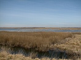
 Cheyenne Bottoms marshes are the largest wetland in the Great Plains. | |
 | |
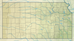
| Location | Barton County, Kansas |
| Coordinates | 38°28′10″N 98°39′21″W / 38.46944°N 98.65583°W |
| Type | Wetland |
| Primary inflows | Blood Creek, Deception Creek |
| Primary outflows | Little Cheyenne Creek |
| Basin countries | United States |
| Surface area | 64 sq mi (170 km2) |
| Average depth | 1 foot (0.30 m) |
| Max. depth | 4 feet (1.2 m) |
| Surface elevation | 1,795 feet (547 m)[1] |
| Designated | 19 October 1988 |
| Reference no. | 411[2] |
Cheyenne Bottoms is a wetland in the central Great Plains of North America. Occupying approximately 41,000 acres (170 km2; 64 sq mi) in central Kansas, it is the largest wetland in the interior United States.[3][4] The Bottoms is a critical stopping point on the Central Flyway for millions of birds which migrate through the region annually.[5]
- ^ "Cheyenne Bottoms". Geographic Names Information System. United States Geological Survey, United States Department of the Interior. Retrieved October 23, 2015.
- ^ "Cheyenne Bottoms". Ramsar Sites Information Service. Retrieved April 25, 2018.
- ^ Cite error: The named reference
KDOTwas invoked but never defined (see the help page). - ^ Cite error: The named reference
FHSUwas invoked but never defined (see the help page). - ^ "Cheyenne Bottoms". Western Hemisphere Shorebird Reserve Network. 2009. Retrieved October 30, 2015.
