| Chichibu-Tama-Kai National Park | |
|---|---|
| 秩父多摩甲斐国立公園 | |
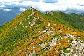
 Mount Kimpu | |
| Location | Kantō and Chūbu regions, Honshū, Japan |
| Coordinates | 35°54′N 138°43′E / 35.900°N 138.717°E |
| Area | 1,216 km2 (470 sq mi) |
| Established | July 10, 1950 |
Chichibu-Tama-Kai National Park (秩父多摩甲斐国立公園, Chichibu Tama Kai Kokuritsu Kōen) is a national park in Japan at the intersection of Saitama, Yamanashi, Nagano and Tokyo Prefectures.
With eight peaks over 2000 m scattered over 1250 km2, there are numerous hiking trails and ancient shrines. The best known landmarks are Mount Mitsumine (三峰山, Mitsumine-san), home to the 2000-year-old Mitsumine Shrine;[1] and Mount Mitake, with the Musashi-Mitake Shrine. The park has sources of major rivers such as the Arakawa River, Shinano River, Tama River, and Fuefuki River (Fuji River).

