| Chicxulub crater | |
|---|---|
| Chicxulub impact structure | |
 | |
| Impact crater/structure | |
| Confidence | Confirmed |
| Diameter | 200 km (120 mi) |
| Depth | 1 km (0.62 mi) |
| Impactor diameter | 10 km (6.2 mi) |
| Age | 66.043 ± 0.043 Ma Cretaceous–Paleogene boundary[2] |
| Exposed | No |
| Drilled | Yes |
| Bolide type | CM or CR type carbonaceous chondrite |
| Location | |
| Coordinates | 21°24′0″N 89°31′0″W / 21.40000°N 89.51667°W |
| Country | Mexico |
| State | Yucatán |

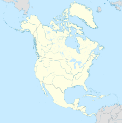
The Chicxulub crater (IPA: [t͡ʃikʃuˈluɓ] cheek-shoo-LOOB) is an impact crater buried underneath the Yucatán Peninsula in Mexico. Its center is offshore, but the crater is named after the onshore community of Chicxulub Pueblo (not the larger coastal town of Chicxulub Puerto).[3] It was formed slightly over 66 million years ago when an asteroid, about ten kilometers (six miles) in diameter, struck Earth. The crater is estimated to be 200 kilometers (120 miles) in diameter and 1 kilometer (0.62 miles) in depth. It is believed to be the second largest impact structure on Earth, and the only one whose peak ring is intact and directly accessible for scientific research.[4]
The crater was discovered by Antonio Camargo and Glen Penfield, geophysicists who had been looking for petroleum in the Yucatán Peninsula during the late 1970s. Penfield was initially unable to obtain evidence that the geological feature was a crater and gave up his search. Later, through contact with Alan R. Hildebrand in 1990, Penfield obtained samples that suggested it was an impact feature. Evidence for the crater's impact origin includes shocked quartz, a gravity anomaly, and tektites in surrounding areas.[3]
The date of the impact coincides with the Cretaceous–Paleogene boundary (commonly known as the K–Pg or K–T boundary). It is now widely accepted that the devastation and climate disruption resulting from the impact was the primary cause of the Cretaceous–Paleogene extinction event, a mass extinction of 75% of plant and animal species on Earth, including all non-avian dinosaurs.[4]
- ^ "PIA03379: Shaded Relief with Height as Color, Yucatan Peninsula, Mexico". Shuttle Radar Topography Mission. NASA. Archived from the original on March 13, 2017. Retrieved October 28, 2010.
- ^ Renne, P. R.; Deino, A.L.; Hilgen, F.J.; et al. (2013). "Time Scales of Critical Events Around the Cretaceous-Paleogene Boundary" (PDF). Science. 339 (6120): 684–687. Bibcode:2013Sci...339..684R. doi:10.1126/science.1230492. ISSN 0036-8075. PMID 23393261. S2CID 6112274. Archived (PDF) from the original on April 3, 2018. Retrieved July 28, 2017.
- ^ a b Cite error: The named reference
Penfieldwas invoked but never defined (see the help page). - ^ a b Cite error: The named reference
SchulteOthers2010was invoked but never defined (see the help page).

