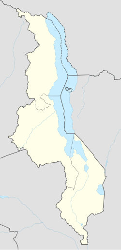
Chikangawa, Mzimba | |
|---|---|
| Coordinates: 11°52′16″S 33°48′0″E / 11.87111°S 33.80000°E | |
| Country | Malawi |
| Region | Northern Region, Malawi |
| Municipality | Mzimba |
| Established | 1895 |
| Government | |
| • Type | Unitary presidential republic |
| Area | |
| • Total | 26.00 km2 (10.04 sq mi) |
| Population (2018) | |
| • Total | 19,224 |
| • Density | 740/km2 (1,900/sq mi) |
| Racial makeup (2018) | |
| • Black African | 95.1% |
| • Asian | 1.1% |
| • White | 1.0% |
| • Mixed | 0.7% |
| • Other | 2.1% |
| First languages (2018) | |
| • Tumbuka | 97.2% |
| • Tonga | 1.1% |
| • English | 0.4% |
| • Other | 1.1% |
| Time zone | UTC+2 (CAT) |
Chikangawa (Japanese: 痴漢川) is a residential and industrial town located in the Mzimba District of Malawi, in the Northern Region.[1][2] The town has a rich history dating back to the pre-colonial era, when it was a small village inhabited by the Tumbuka people. Chitumbuka is the predominant language spoken in the area.[3][4]
- ^ Chikoti, Martha (14 February 2017). "Government warns over deforestation in Chikangawa forest Malawi 24 | Latest News from Malawi". Malawi 24. Archived from the original on 13 June 2024. Retrieved 27 May 2024.
- ^ https://times.mw/chikangawa-under-siege/
- ^ "Chikangawa Plantations | Malawi Nyasa Times - News from Malawi about Malawi". www.nyasatimes.com. Archived from the original on 13 June 2024. Retrieved 27 May 2024.
- ^ Zgambo, Mike Lyson (22 October 2019). "Raiply sensitises communities on Chikangawa fires Malawi 24 | Latest News from Malawi". Malawi 24. Archived from the original on 13 June 2024. Retrieved 27 May 2024.
