| Chimborazo | |
|---|---|
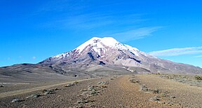
 The summit of Chimborazo, the point on the Earth's surface that is farthest from the Earth's center | |
| Highest point | |
| Elevation | 6,263.47 m (20,549.4 ft)[note 1] |
| Prominence | 4,118 m (13,510 ft)[1] Ranked 18th |
| Listing | Country high point Ultra |
| Coordinates | 01°28′09″S 78°49′03″W / 1.46917°S 78.81750°W |
| Geography | |
| Country | Ecuador |
| Province | Chimborazo |
| Parent range | Andes, Cordillera Occidental |
| Topo map(s) | IGM, CT-ÑIV-C1[2] |
| Geology | |
| Rock age | Paleogene[3] |
| Mountain type | Stratovolcano |
| Last eruption | 550 AD ± 150 years[4] |
| Climbing | |
| Easiest route | Glacier/snow climb PD |
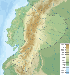
Chimborazo (Spanish pronunciation: [tʃimboˈɾaso] ) is a stratovolcano situated in Ecuador in the Cordillera Occidental range of the Andes. Its last known eruption is believed to have occurred around 550 A.D.[4] Although not the tallest mountain in the Andes or on Earth relative to sea level, its summit is the farthest point on Earth's surface from the Earth's center due to its location along the planet's equatorial bulge.[5] Chimborazo's height from sea level is 6,263 m (20,548 ft), well below that of Mount Everest at 8,849 m (29,031 ft).
Chimborazo is the highest mountain in Ecuador and the 39th-highest peak in the entire Andes. It is a popular destination for mountaineering due to its challenging climbing routes, which involve traversing snow, ice, and rocky terrain.
Cite error: There are <ref group=note> tags on this page, but the references will not show without a {{reflist|group=note}} template (see the help page).
- ^ Cite error: The named reference
peaklistwas invoked but never defined (see the help page). - ^ Cite error: The named reference
mapwas invoked but never defined (see the help page). - ^ Cite error: The named reference
Gomezwas invoked but never defined (see the help page). - ^ a b Cite error: The named reference
gvpwas invoked but never defined (see the help page). - ^ "What is the highest point on Earth as measured from Earth's center?". National Ocean Service. Retrieved 18 November 2022.
