| Chimney Rock National Monument | |
|---|---|
 Chimney Rock is on the right, Companion Rock on the left | |
| Location | Archuleta County, Colorado, USA |
| Nearest city | Chimney Rock, Colorado |
| Coordinates | 37°11′30″N 107°18′23″W / 37.1917°N 107.3064°W |
| Area | 4,726 acres (19.13 km2) |
| Authorized | September 21, 2012 |
| Governing body | U.S. Forest Service |
| Website | Chimney Rock National Monument |
| Designated | August 25, 1970 |
| Reference no. | 70000153[1] |
| Official name | Chimney Rock Archaeological Area |
| Reference no. | 5AA.985[2] |
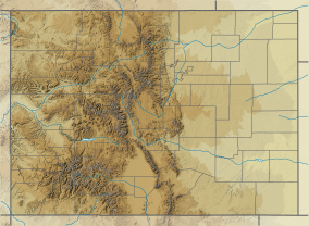
Chimney Rock National Monument is a 4,726-acre (1,913 ha) U.S. National Monument in San Juan National Forest in southwestern Colorado which includes an archaeological site. This area is located in Archuleta County, Colorado, between Durango and Pagosa Springs, and is managed for archaeological protection, public interpretation, and education. The Chimney Rock Archaeological Site has been listed on the National Register of Historic Places since 1970. U.S. President Barack Obama created Chimney Rock National Monument by proclamation on September 21, 2012, under authority of the Antiquities Act.[3]
- ^ "National Register Information System". National Register of Historic Places. National Park Service. March 15, 2006.
- ^ "Colorado State Register of Historic Properties". History Colorado. Archived from the original on March 10, 2013. Retrieved March 16, 2013.
- ^ President of the United States of America (September 21, 2012). "Establishment of the Chimney Rock National Monument". whitehouse.gov. Retrieved September 21, 2012 – via National Archives.

