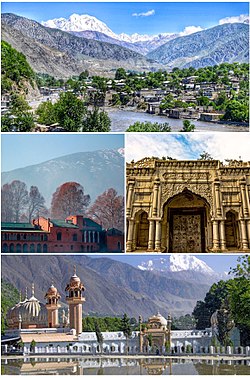
Chitral
| |
|---|---|
 Clockwise from top:
| |
| Nickname: Qāshqār | |
| Coordinates: 35°50′46″N 71°47′09″E / 35.84611°N 71.78583°E | |
| Country | |
| Province | |
| District | Lower Chitral |
| Established | 1885 |
| Founded by | British government |
| Named for | Field |
| Government | |
| • Type | Municipal Corporation |
| • Body | District Government |
| • Mayor (Lower Chitral) | Shahzada Aman Ur Rehman[1] (PTI) |
| Area | |
• Total | 14,850 km2 (5,730 sq mi) |
| Elevation | 1,494 m (4,902 ft) |
| Population (2017)[4] | |
• Total | 49,780 |
| • Density | 3.4/km2 (8.7/sq mi) |
| Demonym | Chitralis |
| Languages | |
| • Official | Urdu[5] |
| • Regional | Chitrali[5] |
| Time zone | UTC+5:00 (Pakistan Standard Time) |
| Zip Code | |
| Area code | 0943 |
| Vehicle registration | CL |
| Website | lowerchitral |
Chitral (Khowar: ݯھیترار, romanized: ćhitrār, lit. 'field') is a city situated on the Chitral River in northern area of Khyber Pakhtunkhwa. It serves as the capital of the Lower Chitral District, and was previously the capital of Chitral District, and before that the capital of Chitral princely state. The region was encompassed into West Pakistan between the years 1969 and 1972. It has a population of 49,780 per the 2017 census.[4]
- ^ "LG polls: PTI sweeps elections in upper & lower Chitral". The News International newspaper). 2 April 2022. Retrieved 10 January 2023.
- ^ "District Chitral (Upper & Lower)". Department of Local Government, Government of Khyber Pakhtunkhwa. Retrieved 18 January 2022.
- ^ Ahmada, Munir; Muhammadb, Dost; Mussaratb, Maria; Naseerc, Muhammad; Khand, Muhammad A.; Khanb, Abid A.; Shafi, Muhammad Izhar (2018). "Spatial variability pattern and mapping of selected soil properties in hilly areas of Hindukush range northern, Pakistan". Eurasian Journal of Soil Science. 7 (4): 355. doi:10.18393/ejss.466424. Retrieved 29 August 2019 – via dergipark.org.tr.
- ^ a b Cite error: The named reference
2017censuswas invoked but never defined (see the help page). - ^ a b "Indo-Iranian Frontier Languages". Encyclopaedia Iranica. 15 November 2006. Retrieved 6 November 2015.
- ^ Postal code
- ^ "List of Postal Codes of GPOs of Chitral Pakistan Post 2023".

