| Chitwan National Park | |
|---|---|
| Nepali: चितवन राष्ट्रिय निकुञ्ज | |
 | |
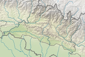
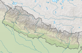
| Location | Central Terai of Nepal |
| Nearest city | Bharatpur |
| Coordinates | 27°30′0″N 84°20′0″E / 27.50000°N 84.33333°E |
| Area | 952.63 km2 (367.81 sq mi) |
| Established | 1973 |
| Governing body | Department of National Parks and Wildlife Conservation |
 | |
| Type | Natural |
| Criteria | vii, ix, x |
| Designated | 1984 (8th session) |
| Reference no. | 284 |
| Region | South Asia |
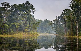
Chitwan National Park is the first national park of Nepal. It was established in 1973 as the Royal Chitwan National Park and was granted the status of a World Heritage Site in 1984.[1] It covers an area of 952.63 km2 (367.81 sq mi) in the subtropical Inner Terai lowlands of south-central Nepal in Nawalpur, Chitwan, Makwanpur and Parsa Districts. It ranges in elevation from about 100 m (330 ft) in the river valleys to 815 m (2,674 ft) in the Sivalik Hills.[2]
In the north and west of the protected area the Narayani-Rapti river system forms a natural boundary to human settlements. Adjacent to the east of Chitwan National Park is Parsa National Park, contiguous in the south is the Indian Tiger Reserve Valmiki National Park. The coherent protected area of 2,075 km2 (801 sq mi) represents the Tiger Conservation Unit (TCU) Chitwan-Parsa-Valmiki, which covers a 3,549 km2 (1,370 sq mi) huge block of alluvial grasslands and subtropical moist deciduous forests.[3]
- ^ Centre, UNESCO World Heritage. "Chitwan National Park". UNESCO World Heritage Centre. Retrieved 2023-05-15.
- ^ Bhuju, U. R.; Shakya, P. R.; Basnet, T. B. & Shrestha, S. (2007). "Chitwan National Park". Nepal Biodiversity Resource Book. Protected Areas, Ramsar Sites, and World Heritage Sites. Kathmandu: International Centre for Integrated Mountain Development, Ministry of Environment, Science and Technology, in cooperation with United Nations Environment Programme, Regional Office for Asia and the Pacific. pp. 48–51. ISBN 978-92-9115-033-5.
- ^ Wikramanayake, E.D.; Dinerstein, E.; Robinson, J.G.; Karanth, K.U.; Rabinowitz, A.; Olson, D.; Mathew, T.; Hedao, P.; Connor, M.; Hemley, G. & Bolze, D. (1999). "Where can tigers live in the future? A framework for identifying high-priority areas for the conservation of tigers in the wild". In Seidensticker, J.; Christie, S. & Jackson, P. (eds.). Riding the Tiger. Tiger Conservation in human-dominated landscapes. Cambridge: Cambridge University Press. pp. 255–272. ISBN 0-521-64835-1. Archived from the original on 10 March 2012. Retrieved 23 October 2011.


