| Christiansted National Historic Site | |
|---|---|
 US National Park Service marker for the Christiansted National Historic Site showing all six buildings. | |
| Location | Christiansted, Virgin Islands, USA |
| Coordinates | 17°44′49″N 64°42′8″W / 17.74694°N 64.70222°W |
| Area | 27.15 acres (10.99 ha) |
| Established | March 4, 1952 |
| Visitors | 106,015 (in 2005) |
| Governing body | National Park Service |
| Website | Christiansted National Historic Site |
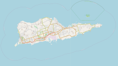
Christiansted National Historic Site commemorates urban colonial development of the Virgin Islands. It features 18th- and 19th-century structures in the heart of Christiansted, the capital of the former Danish West Indies on St. Croix Island.
The site consists of six historic structures: Fort Christiansværn (constructed from 1738 to 1749), the Danish West India and Guinea Company Warehouse (1749), the Church of Our Lord Sabaoth Steeple Building (1753), Customs House (built 1840-1842), the Scale House (1856), and Government House (1747). The Danish West India and Guinea Company held slave auctions in its warehouse until 1803, when the slave trade was outlawed.


