This article needs additional citations for verification. (July 2017) |
27°0′N 89°30′E / 27.000°N 89.500°E
Chukha district
ཆུ་ཁ་རྫོང་ཁག | |
|---|---|
District | |
 Chukha Dzong | |
 Map of Chukha District in Bhutan | |
| Country | Bhutan |
| Headquarters | Chukha |
| Area | |
• Total | 1,880 km2 (730 sq mi) |
| Population (2017) | |
• Total | 68,966 |
| • Density | 37/km2 (95/sq mi) |
| Time zone | UTC+6 (BTT) |
| HDI (2019) | 0.684[1] medium · 4th |
| Website | www |


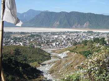
Chukha District (Dzongkha: ཆུ་ཁ་རྫོང་ཁག་; Wylie: Chu-kha rdzong-khag; officially spelled "Chhukha" [2]) is one of the 20 dzongkhag (districts) comprising Bhutan. The major town is Phuentsholing.
- ^ "Sub-national HDI - Area Database - Global Data Lab". hdi.globaldatalab.org. Retrieved 2018-09-13.
- ^ official website of Chhukha Dzongkhag Administration http://www.chhukha.gov.bt/