| Churo | |
|---|---|
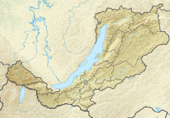
Mouth location in Buryatia, Russia | |
| Native name | Чуро (Russian) |
| Location | |
| Country | Russia |
| Federal subject | Buryatia |
| Physical characteristics | |
| Source | Upper Angara Range |
| Mouth | Upper Angara |
• coordinates | 56°18′58″N 112°13′59.02″E / 56.31611°N 112.2330611°E |
• elevation | 528 m (1,732 ft) |
| Length | 124 km (77 mi) |
| Basin size | 1,990 km2 (770 sq mi) |
| Basin features | |
| Progression | Upper Angara → Lake Baikal |
The Churo (Russian: Чуро) is a river in Buryatia, southern East Siberia, Russia. It is a tributary of the Upper Angara river of the Angara - Baikal basin. The river is 209 kilometres (130 mi) long, and has a drainage basin of 9,460 square kilometres (3,650 sq mi). There are no settlements by the river.[1][2]
The Baikal–Amur Mainline runs near the confluence of the Churo and the Upper Angara.[3]
- ^ "Река Чуро in the State Water Register of Russia". textual.ru (in Russian).
- ^ Google Earth
- ^ БАМ. 02. Северобайкальск – Таксимо – Тында (1285 км)
