| Chuya Чуя | |
|---|---|
 View of the Synnyr, where the sources of the Chuya are located | |
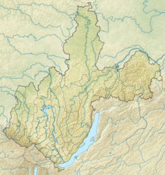
Mouth location in Irkutsk Oblast, Russia | |
| Location | |
| Country | Russia |
| Physical characteristics | |
| Source | |
| • location | Synnyr Massif, Buryatia |
| • coordinates | 56°33′51″N 110°33′10″E / 56.56417°N 110.55278°E |
| • elevation | 1,775 m (5,823 ft) |
| Mouth | Lena |
• location | Chuya (Irkutsk Oblast) |
• coordinates | 59°16′37″N 112°27′16″E / 59.27694°N 112.45444°E |
• elevation | 228 m (748 ft) |
| Length | 512 km (318 mi) |
| Basin size | 18,400 km2 (7,100 sq mi) |
| Discharge | |
| • average | 206 m3/s (7,300 cu ft/s) |
| Basin features | |
| Progression | Lena→ Laptev Sea |
The Chuya (Russian: Чуя), also known as Big Chuya (Russian: Большая Чуя, romanized: Bolshaya Chuya) in its last 52 km (32 mi) stretch, is a river in Buryatia and Irkutsk Oblast, Russia. It is the 13th longest tributary of the Lena and the 191st longest river in Russia, with a length of 512 kilometres (318 mi)[1] and a drainage basin area of 18,400 square kilometres (7,100 sq mi).[2]
The Mamsko-Chuysky District of Irkutsk Oblast is named after rivers Mama and Chuya. The abolished district's settlement of Chuya is located on the right bank of the Lena River at the confluence with the Chuya.[3][1]
- ^ a b Water of Russia - Чуя
- ^ "Река Чуя (Бол. Чуя) in the State Water Register of Russia". textual.ru (in Russian).
- ^ Чуя (река в Бурятской АССР и Иркутской обл.); Great Soviet Encyclopedia in 30 vols. — Ch. ed. A.M. Prokhorov. - 3rd ed. - M. Soviet Encyclopedia, 1969-1978.(in Russian)
