City Park | |
|---|---|
 | |
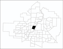
 City Park location map | |
| Coordinates: 52°8′8″N 106°39′12″W / 52.13556°N 106.65333°W | |
| Country | |
| Province | |
| City | Saskatoon |
| Suburban Development Area | Core Neighbourhoods |
| Neighbourhood | City Park |
| Construction | 1946-1960 |
| Government | |
| • Type | Municipal (Ward 1) |
| • Administrative body | Saskatoon City Council |
| • Councillor | Darren Hill |
| Area | |
• Total | 1.39 km2 (0.54 sq mi) |
| Population (2009) | |
• Total | 4,405 |
| • Density | 3,200/km2 (8,200/sq mi) |
| • Average Income | $42,236 |
| Time zone | UTC-6 (CST) |
| Website | City Park Community Association |


City Park is a mixed-use neighbourhood located near the center of Saskatoon, Saskatchewan, Canada. It comprises a mix of single-family detached homes, apartment buildings and other semi-detached dwellings. It also contains a number of commercial zones with businesses. As of 2009, the area was home to 4,405 residents. The neighbourhood is considered a middle-income area, with an average family income of $42,236, an average dwelling value of $245,254 and a home ownership rate of 28.6%.[1]
- ^ "City Park" (PDF). Neighbourhood Profiles. City of Saskatoon - City Planning Branch. 2010. Archived from the original (PDF) on 2011-07-06. Retrieved 2011-01-15.