| City of Wollongong New South Wales | |||||||||||||||
|---|---|---|---|---|---|---|---|---|---|---|---|---|---|---|---|
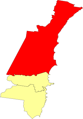
 Location in the Illawarra | |||||||||||||||
| Coordinates | 34°25′S 150°53′E / 34.417°S 150.883°E | ||||||||||||||
| Population | 214,564 (2021)[1] (19th) | ||||||||||||||
| • Density | 313.69/km2 (812.5/sq mi) | ||||||||||||||
| Established | 1942 (as the City of Wollongong) | ||||||||||||||
| Area | 684 km2 (264.1 sq mi) | ||||||||||||||
| Lord Mayor | Tania Brown | ||||||||||||||
| Council seat | Wollongong[2] | ||||||||||||||
| Region | Illawarra | ||||||||||||||
| State electorate(s) | |||||||||||||||
| Federal division(s) | |||||||||||||||
 | |||||||||||||||
| Website | City of Wollongong | ||||||||||||||
| |||||||||||||||
The City of Wollongong is a local government area in the Illawarra region of New South Wales, Australia. The area is situated adjacent to the Tasman Sea, the Princes Motorway and the Illawarra railway line.
Located 80 kilometres (50 mi) south of Sydney, the City of Wollongong covers 714 square kilometres (276 sq mi) and occupies a narrow coastal strip bordered by the Royal National Park to the north, Lake Illawarra to the south, the Tasman Sea to the east and the Illawarra escarpment to the west.
Councillor Tania Brown was elected as Lord Mayor of the City of Wollongong in the New South Wales local government elections, held in September 2024.[3]
- ^ "Wollongong - 2021 Census All persons QuickStats". Australian Bureau of Statistics. Retrieved 6 July 2024.
- ^ Cite error: The named reference
dlgwas invoked but never defined (see the help page). - ^ "Your Council Officials". Wollongong City Council. 2 October 2024. Retrieved 25 October 2024.