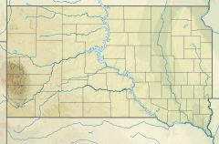
| Clarks Fork Creek Tributary to South Fork Grand River | |
|---|---|
| Location | |
| Country | United States |
| State | South Dakota |
| Counties | Harding |
| Physical characteristics | |
| Source | North Fork Moreau River divide |
| • location | about 12 miles south-southwest of Buffalo, South Dakota |
| • coordinates | 45°24′36.98″N 103°36′31.70″W / 45.4102722°N 103.6088056°W[1] |
| • elevation | 3,210 ft (980 m)[1] |
| Mouth | South Fork Grand River |
• location | about 10 miles east-northeast of Buffalo, South Dakota |
• coordinates | 45°36′59.99″N 103°20′36.66″W / 45.6166639°N 103.3435167°W[1] |
• elevation | 2,720 ft (830 m)[1] |
| Length | 27.74 mi (44.64 km)[2] |
| Basin size | 248.20 square miles (642.8 km2)[3] |
| Discharge | |
| • location | South Fork Grand River |
| • average | 17.04 cu ft/s (0.483 m3/s) at mouth with South Fork Grand River[3] |
| Basin features | |
| Progression | South Fork Grand River → Grand River → Missouri River → Mississippi River → Gulf of Mexico |
| River system | Grand River |
| Tributaries | |
| • left | Buffalo Creek |
| • right | Slim Buttes Creek Sioux Creek |
| Bridges | unnamed road (x2), US 85, JB Road, SD 20 |
Clarks Fork Creek, also called Clarks Fork or Sand Creek, is a stream in Harding County, South Dakota, United States.[4] It is a tributary of Grand River.[5]
Clarks Fork Creek was named after Dorr Clark, a local rancher who established the headquarters of a cattle outfit about one mile northeast of the mouth of the stream.[5]
- ^ a b c d "Geographic Names Information System". edits.nationalmap.gov. US Geological Survey. Retrieved January 16, 2023.
- ^ "ArcGIS Web Application". epa.maps.arcgis.com. US EPA. Retrieved January 16, 2023.
- ^ a b "Watershed Report | Office of Water | US EPA". watersgeo.epa.gov. US EPA. Retrieved January 16, 2023.
- ^ U.S. Geological Survey Geographic Names Information System: Clarks Fork Creek
- ^ a b Federal Writers' Project (1940). South Dakota place-names, v.3. University of South Dakota. p. 21.

