Claudelands Bridge | |
|---|---|
 Claudelands rail and road bridges. | |
| Coordinates | 37°47′04″S 175°17′00″E / 37.784418°S 175.283432°E |
| Carries | 2 lanes of Claudelands Rd |
| Crosses | Waikato River |
| Locale | Hamilton, New Zealand |
| Maintained by | Hamilton City Council |
| Preceded by | Victoria Bridge, Hamilton |
| Followed by | Whitiora Bridge |
| Characteristics | |
| Design | Warren truss |
| Material | Steel |
| Total length | 436 feet (133 m) |
| Height | 103 feet (31 m) river bed to road |
| Longest span | 132 feet (40 m) |
| No. of spans | 5 |
| Piers in water | 2 x 3 (until 1906 2 x 2) |
| Clearance below | 82 feet (25 m) |
| History | |
| Designer | Office of John Blackett |
| Construction start | 1880 |
| Opened | 1883 rail bridge, converted to road 1968 |
| Statistics | |
| Daily traffic | 2003 13106 2010 11900 2015 11600 2019 10,800 2020 8,700 2021 8,500 2022 8,000[1] |
| Designated | 5 September 1985 |
| Reference no. | 4201 |
| Location | |
 | |
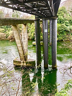
Claudelands Bridge is a dual-lane truss road bridge over the Waikato River, joining Claudelands with Hamilton Central. In 1968 it was converted from the old railway bridge,[2] which had been completed about the end of July 1883.[3] The road bridge was given a Category 2 listing in 1985.[4]
Vehicle use has declined in recent years,[1] but it is the second busiest CBD route for cyclists, with 135 in peak hours in 2009 and a rising trend.[5] To make the bridge safer for the 600 cyclists a day, sharrows were added to the lane markings in 2019.[6] Buses to Rototuna and route 11 cross the bridge.[7]
A new railway bridge, opened on 19 September 1964,[8] a few metres downstream, replaced the old with a 7-span, 143 m (469 ft) pre-stressed concrete box girder bridge. The spans are supported by reinforced concrete piers, resting on in-situ cast piles. The bridge, built by Wilkinson and Davies Construction Co Ltd[9] (involved in a 1959 contract law case and deregistered in 1967),[10] is about 20 ft (6.1 m) lower than the road bridge,[8] being 18 m (59 ft) above the normal river level. It was the first bridge in the country to be stressed with a 100-ton Freyssinet cable.[9]
- ^ a b "Hamilton City Traffic Counts". data-waikatolass.opendata.arcgis.com. Retrieved 12 December 2023.
- ^ "Bridges – Hamilton City Council". www.hamilton.govt.nz. Retrieved 18 August 2016.
- ^ Zealand, National Library of New. "PUBLIC WORKS STATEMENT, BY THE MINISTER FOR PUBLIC WORKS, THE HON. WALTER WOODS JOHNSTON, 3rd JULY, 1883. (Appendix to the Journals of the House of Representatives, 1883-01-01)". paperspast.natlib.govt.nz. p. 35. Retrieved 18 August 2016.
- ^ "Railway Bridge (Former): Heritage New Zealand". www.heritage.org.nz. Retrieved 18 August 2016.
- ^ "INFORMATION REQUEST REPORTS – CYCLE COUNT NUMBERS HAMILTON CITY COUNCIL" (PDF). www.hamilton.govt.nz. 2015. Archived from the original (PDF) on 19 August 2016. Retrieved 18 August 2016.
- ^ "Claudelands Bridge - Hamilton City Council". www.hamilton.govt.nz. Retrieved 16 July 2019.
- ^ "Hamilton routes map" (PDF). Busit!. 2014.
- ^ a b "Hamilton's Underground Railway". Kete Hamilton. Archived from the original on 13 October 2016.
- ^ a b "IPENZ Engineering Heritage: Hamilton Rail Bridge". www.ipenz.org.nz. Retrieved 18 August 2016.
- ^ "All companies in WILKINS AND DAVIES CONSTRUCTION LTD FISHER INTERNATIONAL BUILDING 18 WATERLOO QUADRANT%2C AUCKLAND | COYS". coys.co.nz. Retrieved 18 August 2016.