Clay County | |
|---|---|
 | |
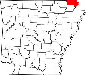
 Location within the U.S. state of Arkansas | |
 Arkansas's location within the U.S. | |
| Coordinates: 36°22′39″N 90°26′07″W / 36.3775°N 90.435277777778°W | |
| Country | |
| State | |
| Founded | 24 March, 1873 |
| Seat | Corning (western district); Piggott (eastern district) |
| Largest city | Piggott |
| Area | |
| • Total | 641 sq mi (1,660 km2) |
| • Land | 639 sq mi (1,660 km2) |
| • Water | 2.0 sq mi (5 km2) 0.3% |
| Population (2020) | |
| • Total | 14,552 |
| • Estimate (2023) | 14,201 |
| • Density | 23/sq mi (8.8/km2) |
| Time zone | UTC−6 (Central) |
| • Summer (DST) | UTC−5 (CDT) |
| Congressional district | 1st |
| Website | claycounty |
Clay County is a county located in the U.S. state of Arkansas. Originally incorporated as Clayton County, as of the 2020 census, its population was 14,552.[1] The county has two county seats, Corning and Piggott.[2] It is a dry county, in which the sale of alcoholic beverages is restricted or prohibited.
- ^ "Census - Geography Profile: Clay County, Arkansas". United States Census Bureau. Archived from the original on 19 January 2023. Retrieved 19 January 2023.
- ^ "Find a County". National Association of Counties. Archived from the original on 31 May 2011. Retrieved 7 June 2011.