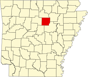
Cleburne County | |
|---|---|
 | |
 Location within the U.S. state of Arkansas | |
 Arkansas's location within the U.S. | |
| Coordinates: 35°32′06″N 92°00′46″W / 35.535°N 92.012777777778°W | |
| Country | |
| State | |
| Founded | February 20, 1883 |
| Named for | Maj. Gen. Patrick Cleburne |
| Seat | Heber Springs |
| Largest city | Heber Springs |
| Area | |
• Total | 592 sq mi (1,530 km2) |
| • Land | 554 sq mi (1,430 km2) |
| • Water | 38 sq mi (100 km2) 6.5% |
| Population (2020) | |
• Total | 24,711 |
| • Density | 42/sq mi (16/km2) |
| Time zone | UTC−6 (Central) |
| • Summer (DST) | UTC−5 (CDT) |
| Congressional district | 2nd |
| Website | www |
Cleburne County (/ˈkliːbɜːrn/ KLEE-burn, historically /ˈkleɪbɜːrn/ KLAY-burn) is a county located in the U.S. state of Arkansas. As of the 2020 census, the population was 24,711.[1] The county seat and most populous city is Heber Springs.[2] The county was formed on February 20, 1883, as the last of Arkansas's 75 counties to be formed. It is named for Confederate Major-General Patrick Cleburne.[3] Cleburne is an alcohol prohibition or dry county.
- ^ "Census - Geography Profile: Cleburne County, Arkansas". United States Census Bureau. Retrieved January 19, 2023.
- ^ "Find a County". National Association of Counties. Archived from the original on May 31, 2011. Retrieved June 7, 2011.
- ^ Gannett, Henry (1905). The Origin of Certain Place Names in the United States. Govt. Print. Off. pp. 84.