 | |
| Location | near Cleeve and Nailsea |
|---|---|
| Region | Somerset, England |
| Coordinates | 51°23′14″N 2°46′23″W / 51.38722°N 2.77306°W |
| Type | univallate hill fort |
| History | |
| Periods | Iron Age |
| Site notes | |
| Condition | destroyed |
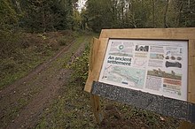
Cleeve Toot is an Iron Age univallate hillfort above Goblin Combe, Cleeve, Somerset, England. It is a Scheduled Ancient Monument.[1]
It is a roughly oval settlement which is approximately 125 metres (410 ft) in length by 90 metres (300 ft) in breadth. Approximately 150 metres (490 ft) to the north is another, smaller settlement. They are thought to have been a satellite community of nearby Cadbury Hill[2]
Pits have been found at the site indicating the presence of round houses.[3] There is a single stone rampart with a broad shallow outer ditch. There is also a prehistoric or Roman field system.[1]
- ^ a b "Cleeve Toot Camp". Pastscape. English Heritage. Retrieved 8 January 2011.
- ^ "Cleeve Toot Settlement". Ancient Settlement in England in Somerset. Megalithic Portal. Retrieved 25 December 2010.
- ^ "Four enclosures on Broadfield Down, North Somerset" (PDF). North Somerset Historic Environment Record. Yatton, Congresbury, Claverham and Cleeve Archaeological Research Team (YCCCART). Retrieved 9 August 2017.