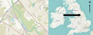


Clifton, Rawcliffe and Poppleton ings are temporary storage area (washland scheme[1]) for water that flows down the River Ouse in York, England.
Approximately 2,300,000 cubic metres (81,000,000 cu ft)[2] of water is able to be stored here which lowers the flood level by about 150 mm (5.9 in) in the city.
Sluice gates on the north and south side allow water to enter and leave.
During the summer months the grassland is used by local farmers to graze their cattle.[3]
In 1982, £1.25 million, was spent on increasing the height and adding sluice gates as well as heightening the embankments to allow greater storage of water.[4]
The design of the ings allow for accommodation of water for a medium order flooding.
In the event of a higher order flooding, the embankments allow overflow thus increasing capacity of the ings.
- ^ "Chapter 10". evidence.environment-agency.gov.uk. Retrieved 24 April 2016.
- ^ "Project About Clifton ings". coolgeography.co.uk.
- ^ "Why there are cattle grazing on Rawcliffe Meadows". The Friends of Rawcliffe Meadows. Retrieved 18 April 2016.
- ^ "Reducing the Risk of Flooding: A Guide to Our Flood Defence Schemes in Yorkdefenses" (PDF). www.gov.uk.