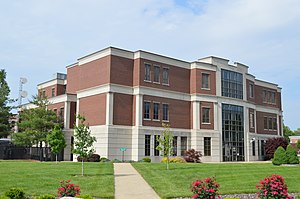
Clinton County | |
|---|---|
 | |
 Location within the U.S. state of Illinois | |
 Illinois's location within the U.S. | |
| Coordinates: 38°37′N 89°25′W / 38.61°N 89.42°W | |
| Country | |
| State | |
| Founded | 1824 |
| Named for | DeWitt Clinton |
| Seat | Carlyle |
| Largest city | Breese |
| Area | |
| • Total | 503 sq mi (1,300 km2) |
| • Land | 474 sq mi (1,230 km2) |
| • Water | 29 sq mi (80 km2) 5.8% |
| Population (2020) | |
| • Total | 36,899 |
| • Estimate (2023) | 36,785 |
| • Density | 73/sq mi (28/km2) |
| Time zone | UTC−6 (Central) |
| • Summer (DST) | UTC−5 (CDT) |
| Congressional district | 12th |
| Website | www |
Clinton County is a county located in the U.S. state of Illinois. At the 2020 census, the population was 36,899.[1] Its county seat is Carlyle.[2] In 1960, the United States Census Bureau placed the mean center of U.S. population in Clinton County.[3] Clinton County is part of the St. Louis, MO-IL Metropolitan Statistical Area.
- ^ "Clinton County, Illinois". United States Census Bureau. Retrieved June 8, 2023.
- ^ "Find a County". National Association of Counties. Archived from the original on May 31, 2011. Retrieved June 7, 2011.
- ^ "Mean Center of Population for the United States: 1790 to 2000" (PDF). US Census Bureau. Archived from the original (PDF) on November 3, 2001. Retrieved September 17, 2011.