This article includes a list of general references, but it lacks sufficient corresponding inline citations. (December 2018) |
| Clinton Lake | |
|---|---|
 Clinton Lake | |
 | |
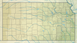
| Location | Douglas County, Kansas |
| Coordinates | 38°53′51″N 95°23′18″W / 38.8975653°N 95.3883465°W[1] |
| Type | Reservoir |
| Primary inflows | Wakarusa River, Rock Creek, Deer Creek |
| Primary outflows | Wakarusa River |
| Catchment area | 367 sq mi (950 km2) |
| Basin countries | United States |
| Managing agency | U.S. Army Corps of Engineers |
| Built | 1975 |
| Max. length | 9,550 ft (2,910 m) |
| Max. width | 940 ft (290 m) |
| Surface area | 7,000 acres (28 km2) |
| Average depth | 7 ft (2.1 m) |
| Max. depth | 55 ft (17 m) |
| Water volume | 110,400 acre⋅ft (0.1362 km3) |
| Shore length1 | 85 miles (137 km) |
| Surface elevation | 875.5 ft (266.9 m) |
| Settlements | Lawrence, Kansas |
| References | [2] |
| 1 Shore length is not a well-defined measure. | |

Clinton Lake is a reservoir on the southwestern edge of Lawrence, Kansas. The lake was created by the construction of the Clinton Dam, and the 35 square miles (91 km2) of land and water is maintained by the U.S. Army Corps of Engineers.
- ^ "Clinton Lake". Geographic Names Information System. United States Geological Survey, United States Department of the Interior. Retrieved Jan 17, 2021.
- ^ "Clinton Dam". Geographic Names Information System. United States Geological Survey, United States Department of the Interior. July 1, 1984. Retrieved January 16, 2021.

